File:Ames St 1910.png: Difference between revisions
From Taylor Wiki
Taylor Instrument Companies' early manufacturing facility featuring the distinctive comb-tooth factory wings along Ames Street. <div style="font-size: 0.85em; color: #64748b; margin-top: 8px; font-style: italic;"> Plat maps and historical aerial imagery courtesy of the [https://maps.cityofrochester.gov/historic/ City of Rochester Historic Map Viewer]. </div> |
No edit summary |
||
| Line 5: | Line 5: | ||
Plat maps and historical aerial imagery courtesy of the [https://maps.cityofrochester.gov/historic/ City of Rochester Historic Map Viewer]. | Plat maps and historical aerial imagery courtesy of the [https://maps.cityofrochester.gov/historic/ City of Rochester Historic Map Viewer]. | ||
</div> | </div> | ||
[[Category:Photos]] | |||
Latest revision as of 02:50, 19 October 2026
Summary
Taylor Instrument Companies' early manufacturing facility featuring the distinctive comb-tooth factory wings along Ames Street.
Plat maps and historical aerial imagery courtesy of the City of Rochester Historic Map Viewer.
File history
Click on a date/time to view the file as it appeared at that time.
| Date/Time | Thumbnail | Dimensions | User | Comment | |
|---|---|---|---|---|---|
| current | 17:56, 17 October 2026 | 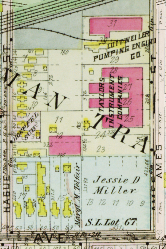 | 540 × 806 (951 KB) | Admin (talk | contribs) | Taylor Instrument Companies' early manufacturing facility featuring the distinctive comb-tooth factory wings along Ames Street. <div style="font-size: 0.85em; color: #64748b; margin-top: 8px; font-style: italic;"> Plat maps and historical aerial imagery courtesy of the [https://maps.cityofrochester.gov/historic/ City of Rochester Historic Map Viewer]. </div> |
You cannot overwrite this file.
File usage
The following page uses this file:


